|
|
|||
|
GUADALUPE MOUNTAINS |
|||
|
|
|||
|
Map of Pine Springs & Guadalupe Mountains National Park Area & Additional Information |
|||
 Today
Pine Springs is a bit of a ghost town. In its heyday, back in the 1850s, when
the town was a station stop on the Butterfield Overland Mail Route, Pine Springs
had a population of around 5,000. The population of Pine Spring is currently
around 20. Today
Pine Springs is a bit of a ghost town. In its heyday, back in the 1850s, when
the town was a station stop on the Butterfield Overland Mail Route, Pine Springs
had a population of around 5,000. The population of Pine Spring is currently
around 20.Crumbling stone ruins and a granite historical marker are all that remain old Pine Springs. Near the Pine Springs Visitor Center you can view the ruins of
the Butterfield Overland Mail Stagecoach Station. |
|||
|
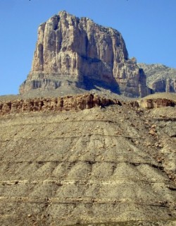
Guadalupe Mountains National Park is the best part of a majestic mountain range
that rises from the flat West Texas desert like a mirage. Looking at the range
from outside the park one can not see that beyond the range's barren outer lies
a forested interior where you will find stands of Ponderosa Pine, Maple, Aspen,
Madrona and Mountain Juniper. The highest point in Texas, at 8,749 feet, is on top of Guadalupe Peak. Inside Guadalupe National Park there are more than 80 miles of hiking, horseback riding and backpacking trails. There are 10 backcountry campgrounds. |
|
||
|
The Guadalupe Peak Trail is a strenuous day hike that take you
to the summit of Guadalupe Peak. It is an 8.4 mile round-trip hike with a view
at the top that is worth the effort caused by the 3,000 foot elevation gain. The
trail winds through forests of Pinon Pine and Douglas Fir, with views of El
Capitan and the Chihuahuan desert. Permits are required for overnight trips. Camping is allowed only in designated area. You check in and out at the Pine Springs Visitor Center. The Frijole Ranch House, built in the 1870s, is now a cultural history museum. |
|||
|
|
|||
|
|||
|
|
|||
|
Visit
our Eyes on Texas Blog to make a comment or share info about the Guadalupe Mountains |
|||
|
|
|||
|
|
|||
| HOME TEXAS TOWNS PARADES | |||
|
|
|||
| BIG BEND COUNTRY | |||
| GULF COAST PINEY WOODS | |||
| PRAIRIE & LAKES HILL COUNTRY | |||
| SOUTH TEXAS PLAINS | |||
| PANHANDLE PLAINS | |||
|
|
|||
| Del Rio El Paso Fort Davis | |||
| Fort Stockton Langtry Marfa | |||
| Midland Monahans Odessa Pecos | |||
| Sanderson Terlingua Wink | |||
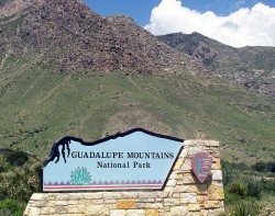
| Guadalupe Mountains National Park | |||
 More than half of Guadalupe Mountains National Park is
designated a wilderness, meaning there is no development.
More than half of Guadalupe Mountains National Park is
designated a wilderness, meaning there is no development. 