|
|
|||
|
PINE SPRINGS TEXAS
& |
|||
|
|
|||
|
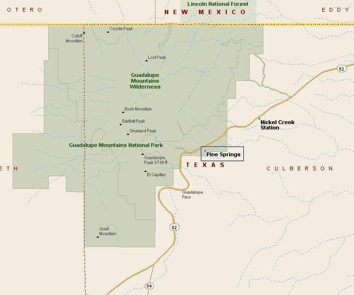
Pine Springs and Guadalupe Mountains National Park are in Culberson County. Pine Springs is the closest settlement to the headquarters of Guadalupe Mountains National Park. Pine Springs and the entry to Guadalupe Mountains National Park is located on U.S. Routes 62/80. Guadalupe Mountains National Park covers 135 square miles and is part of the same mountain range that contains Carlsbad Caverns National Park, which is in New Mexico, about 25 miles north. |
|
||
|
|
|||
|
|
|||
|
|||
|
|
|||
|
Visit
our Eyes on Texas Blog to make a comment or share info about the Guadalupe Mountains |
|||
|
|
|||
|
|
|||
| HOME TEXAS TOWNS PARADES | |||
|
|
|||
| BIG BEND COUNTRY | |||
| GULF COAST PINEY WOODS | |||
| PRAIRIE & LAKES HILL COUNTRY | |||
| SOUTH TEXAS PLAINS | |||
| PANHANDLE PLAINS | |||
|
|
|||
| Del Rio El Paso Fort Davis | |||
| Fort Stockton Langtry Marfa | |||
| Midland Monahans Odessa Pecos | |||
| Sanderson Terlingua Wink | |||
| Guadalupe Mountains National Park | |||