|
|
|||
|
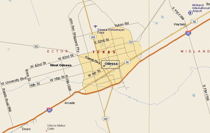
ODESSA TEXAS MAP |
|||
|
|
|||
|
Odessa, Texas is the county seat of Ector County. A
small part of eastern Odessa extends into Midland County. Odessa is about 15 miles southwest of Midland, El Paso is some 270 miles to the west, Fort Worth is 290 miles to the east. As you can on the map, Odessa is situated north of Interstate 20. Other major highways bringing vehicles to and from Odessa are U.S. Highway 385 and Texas Highway 191. Air transport for Odessa is provided by Midland International Airport, located between Odessa and Midland. Schlemeyer Field is Odessa's Regional Airport. |
|
||
|
|
|||
|
|
|||
|
|||
|
|
|||
|
Visit
our Eyes on Texas Blog to make a comment or share info about Odessa |
|||
|
|
|||
|
|
|||
| HOME TEXAS TOWNS PARADES | |||
|
|
|||
| BIG BEND COUNTRY | |||
| GULF COAST PINEY WOODS | |||
| PRAIRIE & LAKES HILL COUNTRY | |||
| SOUTH TEXAS PLAINS | |||
| PANHANDLE PLAINS | |||
|
|
|||
| Del Rio El Paso Fort Davis | |||
| Fort Stockton Langtry Marfa | |||
| Midland Monahans Odessa Pecos | |||
| Sanderson Terlingua Wink | |||
| Guadalupe Mountains National Park | |||