|
ENCHANTED ROCK STATE NATURAL AREA |
|||
| HOME TEXAS REGIONS | |||
|
|
|||
|
|||
| CLICK HERE FOR DIRECTIONS & MAP OF THE ENCHANTED ROCK AREA | |||
|
click a thumbnail to view a
photo
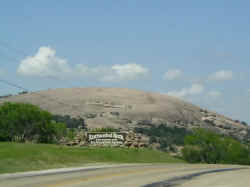
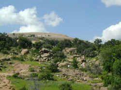
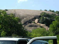
Driving north from Frederickburg, about 17 miles north, you drive over a ridge and around a corner and the baldest hill in Hill Country, Enchanted Rock, comes into view. |
||
|
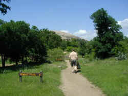
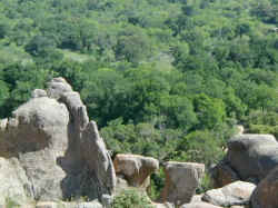
The Summit Trail, as the route to the top is called, begins benign enough, nice and flat and green. |
||

|
The trail follows a semi-dry creek bed for a bit before beginning its punishing ascent. |
||
|
|||
|
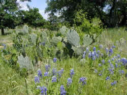
Along the trail, bluebonnets and cactus. A totally Texas combination. |
||
|
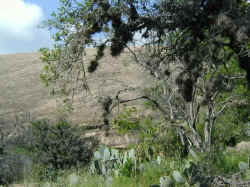
Some more cactus as Enchanted Rock comes clearly into view. |
||
|
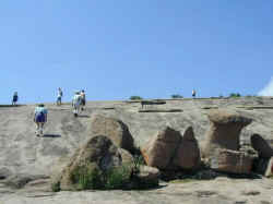
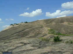
The trail grows steeper. Hikers can been seen starting their trek to the top. |
||

|
The vegetation grows sparser and the number of others struggling towards the top seems to grow. |
||
|
|||
|
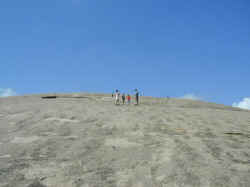
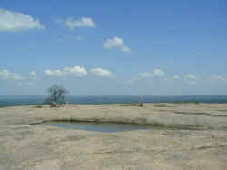
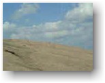
Nothing green visible. Apparently in Texas you get above the timberline at a very low elevation. |
||
|
The discussion between the two bigger people you see here could be clearly heard. Mom could go no further. The kids wanted to go to the top. Dad would take them, but was mom sure she could make it back down safely. |
||
|
|||

|
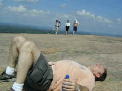
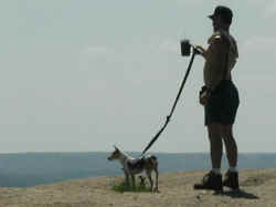
Big Ed, having missed the mountains of Washington, pretty much ran up Enchanted Rock. He later paid for this over exuberance. As you shall see. |
||

|
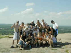
The people go up, the people go down, from dawn to dusk, by the thousands on some days. So many people that the park has to close at times. |
||
|
|||
|
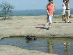
When the chronicler of these events finally reached the top Big Ed was found collapsed and passed out, (he claimed to be napping), light headed and was certain he was suffering from mild heat stroke. Ed had passed out by a small watering hole which he was tempted to drink from until he saw a dog use it as a bath. |
||
|
The doggy bath pond. |
||
|
With a doggy in it. |
||
|
|||
|
This group was desperate for water and about to drink from the pond until that dog showed up! |
||
|
This cute little Rat Dog also swam and drank in the pond after making it to the summit. It seems a warning sign is needed. At some point in the day some desperate for water human likely sees that water and takes a drink not realizing it is a canine bathtub. |
||

|
With Big Ed semi-recovered from his near heat stroke and fearing sunburns it's time to head back down. You sort of just head down any way you want. This is towards what is called Little Enchanted Rock. |
||
|
Utahesque rock formations. Although not redrock. And not quite pink, even though it is very rare pink granite. |
||
|
A view from the other side, looking up, on the way back down. |
||
|
A picnic was had at this spot, looking up at Enchanted Rock. |
||
| Hope you enjoyed the Easter hike up Enchanted Rock. Next time remember sunscreen. | |||
|
|
|||
|
|||
|
|
|||
|
|
|||
|
Visit our Eyes on Texas Blog
to make a comment about Enchanted Rock |
|||
|
|
|||
| HOME TEXAS TOWNS PARADES | |||
|
|
|||
| BIG BEND COUNTRY | |||
| GULF COAST PINEY WOODS | |||
| PRAIRIE & LAKES HILL COUNTRY | |||
| SOUTH TEXAS PLAINS | |||
| PANHANDLE PLAINS | |||
|
|
|||
| Enchanted Rock State Park | |||
 The Enchanted Rock State Natural
Area is
part of the Texas State park system despite its official name having
it be a 'natural area' rather than a park. Enchanted Rock is a huge monolith of rare pink granite
rising 425 feet above a rugged landscape, visible for miles. So named because Tonkawa Indians and early
settlers thought the rock to be possessed of spirits due to noises
which seemed to come from deep inside.
The Enchanted Rock State Natural
Area is
part of the Texas State park system despite its official name having
it be a 'natural area' rather than a park. Enchanted Rock is a huge monolith of rare pink granite
rising 425 feet above a rugged landscape, visible for miles. So named because Tonkawa Indians and early
settlers thought the rock to be possessed of spirits due to noises
which seemed to come from deep inside.
