|
|
|||
|
HOLIDAY
TRAIL |
|||
|
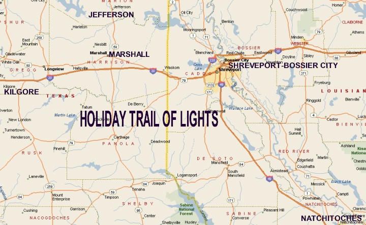
Natchitoches is at the far southeast end of the Holiday Trail of Lights, reached via Interstate 49. Slightly northwest of Natchitoches, where Interstates 49 and 20 intersect, you'll find Shreveport and Bossier City. Kilgore is the furthest west on the Holiday Trail of Lights, located a short distance south of Interstate 20. Marshall is a short distance north of Interstate 20, on Texas State Highway 59. Jefferson is the furthest north city on the Holiday Trail of Lights, located north of Marshall, also on Texas State Highway 59. |
|
||
|
|
|||
|
|
|||
|
|||
|
|
|||
|
Visit
our Eyes on Texas Blog to make a comment or share info about Holiday Trail of Lights |
|||
|
|
|||
|
|
|||
| HOME TEXAS TOWNS PARADES | |||
|
|
|||
| BIG BEND COUNTRY | |||
| GULF COAST PINEY WOODS | |||
| PRAIRIE & LAKES HILL COUNTRY | |||
| SOUTH TEXAS PLAINS | |||
| PANHANDLE PLAINS | |||
|
|
|||
| Conroe Huntsville Jefferson | |||
| Nacogdoches Marshall Gilmer | |||
| Rusk Tyler Kilgore | |||
| Big Thicket National Preserve | |||