|
|
|||
|
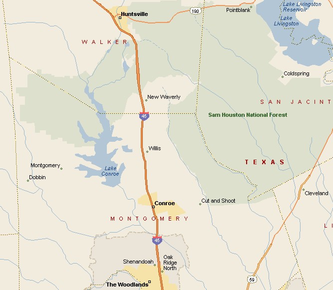
CONROE AREA MAP |
|||
|
Conroe, Texas has a population estimated to be 43,402 in 2004. Conroe is the seat of Montgomery County, sitting about 40 miles north of Houston. Downtown Conroe is located about 7 miles southeast of Lake Conroe. Interstate 45 connects Conroe to Houston to the south and Dallas to the north. During the 1930s, due to the oil boom, Conroe had more millionaires per capita than any other city in America. In 1950 Elvis Presley swiveled his hips at the downtown Conroe Crighton Theatre. Elvis later became the King of Rock and Roll. |
|
||
|
|
|||
|
|
|||
|
|||
|
|
|||
|
Visit
our Eyes on Texas Blog to make a comment or share info about Conroe |
|||
|
|
|||
|
|
|||
| HOME TEXAS TOWNS PARADES | |||
|
|
|||
| BIG BEND COUNTRY | |||
| GULF COAST PINEY WOODS | |||
| PRAIRIE & LAKES HILL COUNTRY | |||
| SOUTH TEXAS PLAINS | |||
| PANHANDLE PLAINS | |||
|
|
|||
| Conroe Huntsville Jefferson | |||
| Nacogdoches Marshall Gilmer | |||
| Rusk Tyler Kilgore | |||
| Big Thicket National Preserve | |||