MOUNT BAKER

Washington Home


Mount Baker from Mount Vernon
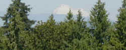
Mount Baker (elevation 10,778 feet) is a glaciated andesitic stratovolcano in the Cascade Volcanic Arc in the Cascade Mountains of Washington State. Mount Baker is easily visible from  Victoria, Vancouver and the Fraser Valley, which is just across the Canadian border to the north, and especially from the towns of Mission and Abbotsford—as well as from locations in Everett, Mount Vernon, Anacortes, Burlington the Skagit Valley and even Seattle to the southwest. 

During the Skagit Valley Tulip Festival Mount Baker is often in photos featuring the fields of tulips. 

Local Native Americans call the mountain "Koma Kulshan," but the explorer George Vancouver named the mountain for 3rd Lieutenant Joseph Baker of the HMS Discovery, who on April 30, 1792 became the first European to see it......more Mount Baker info below....


Mount Baker near Mount Vernon

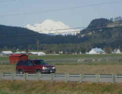
 click thumbnails to enlarge 

A famous view of Mount Baker, from Interstate 5 just south of Mount Vernon. 

Bridge on the trail to Mount Baker 
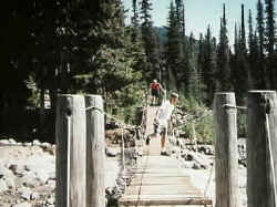
The road ends and the trail begins at Schrieber's Meadow. You can pick the tastiest wild blueberries at Schrieber's Meadow in the fall. A footbridge takes you over Sulphur Creek on the hike to Park Butte and the Railroad Grade on Mount Baker. Before the bridge was built crossing the creek could be difficult late in a summer day with snow melt from Easton Glacier flooding the creek.
Hiking up Mount Baker. 
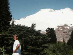
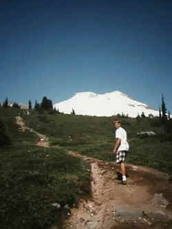
Our trail guide leading us ever closer to Mount Baker. The trail switchbacks through heavy forest for a long hard steep mile or so before breaking out into the open at the lower part of Moritz Meadow.
Moritz Meadow on Mount Baker We are now out of the trees, hiking up Moritz Meadow. The trail guides grows impatient with his slow followers.
The Railroad Grade on Mount Baker. 
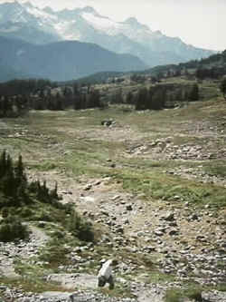
Now on the Railroad Grade, which is the name for the moraine carved out by the Easton Glacier. It is a steep hike at this point with a drop off on one side looking down on what looks like a wasteland of broken rock.
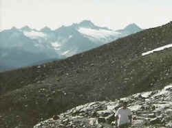
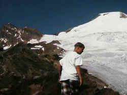
As you go higher and higher the temperatures drop and the elevation makes the hiking even more strenuous as you struggle to get enough oxygen.
Nearing the end of the trail on Mount Baker, 
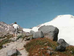
We are nearing where rock meets ice and where the hiking has to end. You can often see Mount Baker's volcanic crater venting steam the Skagit Valley. When you are on the mountain the steaming crater seems much more active. 
Mount Baker Our trail guide is looking down over the Railroad Grade into the steep abyss where you can see chunks of glacier break off making eerie noises. 
The end of the trail on Mount Baker. 
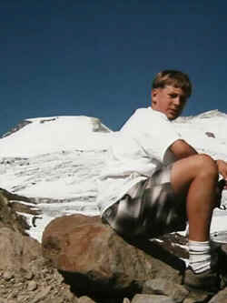
Taking a break at the end of the trail, with our trail guide blocking a good look at the steam coming out of the crater.
After Mount Rainier, Baker is the most heavily glaciated of the Cascade volcanoes: the volume of snow and ice on Mount Baker (0.43 cubic miles) is greater than that of all the other Cascades volcanoes (except Rainier) combined. It is also one of the snowiest places in the world: in 1999, Mount Baker Ski Area, located on a subsidiary peak, set the world record for snowfall in a single season. (1,140 inches/95 feet).

The present-day cone of Mount Baker is relatively young, perhaps less than 30,000 years old, but it sits atop a similar older volcanic cone called Black Buttes Volcano which was active between 500,000 and 300,000 years ago. Much of Mount Baker's earlier geological record was eroded away during the last ice age (which culminated 15,000-20,000 years ago), by thick ice sheets that filled the valleys and covered much of the region. In the last 14,000 years, the area around the mountain has been largely ice free, but the mountain itself remains heavily mantled with snow and ice.

Isolated ridges of lava and hydrothermally altered rock, especially in the area of Sherman Crater, are exposed between glaciers on the upper flanks of the volcano: the lower flanks are steep and heavily vegetated. The volcano rests on a foundation of non-volcanic rocks in a region that is largely non-volcanic in origin.

Deposits which record the last 14,000 years at Mount Baker indicate that Mount Baker has not had highly explosive eruptions like those of Mount St. Helens, Mount Meager or Glacier Peak, nor has it erupted frequently. During this period only four episodes of magmatic eruptive activity can be definitively recognized. Magmatic eruptions have produced tephra, pyroclastic flows, and lava flows from summit vents and from the Schriebers Meadow cinder cone. However, the most destructive and most frequent events at Mount Baker have been debris flows and debris avalanches, many, if not most, of which were not related to magmatic activity but may have been induced by steam emissions, earthquakes, heavy rainfall, or in some other way.

Historical activity at Mount Baker includes several explosions during the mid-19th century, which were witnessed from the Bellingham area, and numerous small-volume debris avalanches since the late 1950s. In early March, 1975, a sudden and dramatic increase in fumarolic activity and snow melt in the Sherman Crater area caused concern that an eruption might be imminent. Additional monitoring equipment was installed and several geophysical surveys were conducted to try to detect the movement of magma. The level of Baker Lake was lowered and people were restricted from the area due to concerns that an eruption-induced debris avalanche or debris flow might enter Baker Lake and displace enough water to either cause a wave to overtop the Upper Baker Dam or cause complete failure of the dam. However, few anomalies other than the increased heat flow were recorded during the geophysical surveys, nor were any other precursory activities observed to indicate that magma was moving up into the volcano. An increased level of fumarolic activity has continued at Mount Baker from 1975 to the present, but there are no other changes that suggest that magma movement is involved.

There are 10 main glaciers on the mountain. All retreated during the first half of the century, advanced from 1950-1975 and have been retreating increasingly rapidly since 1980. The Coleman Glacier is the largest with a surface area of 5.2 km² (Post et al., 1971). The other large glaciers, with areas greater than 2.5 km², are Roosevelt, Mazama, Park, Boulder, Easton and Deming Glaciers.

source: Wikipedia


Cascade Mountain Links

Washington Link List


email