|
|
|||
|
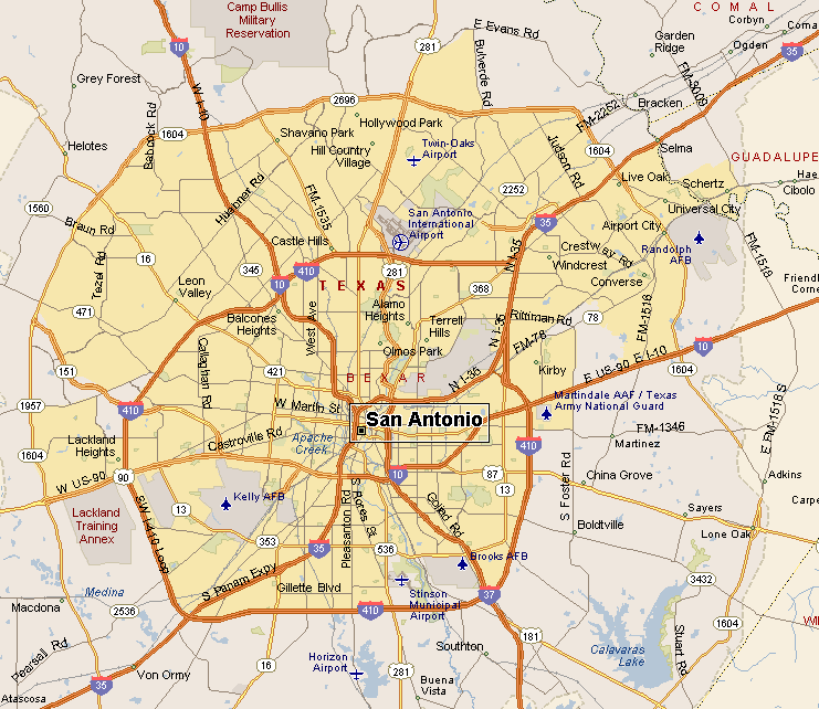
SAN ANTONIO MAPS |
|||
|
San Antonio is the county seat of Bexar County. With a population of around 1.4 million, at last count, San Antonio is the 2nd largest city in Texas and the 7th largest in America. San Antonio is located in the northern part of the South Texas Plains Region, on the southern border of Texas Hill Country. San Antonio was named after a Portuguese saint named Saint Anthony. A Spanish Expedition stopped in the San Antonio area on Saint Anthony's Feast Day of June 13, 1691 and somehow that evolved into this location being called San Antonio. |
|
||
|
|||
|
|
|||
|
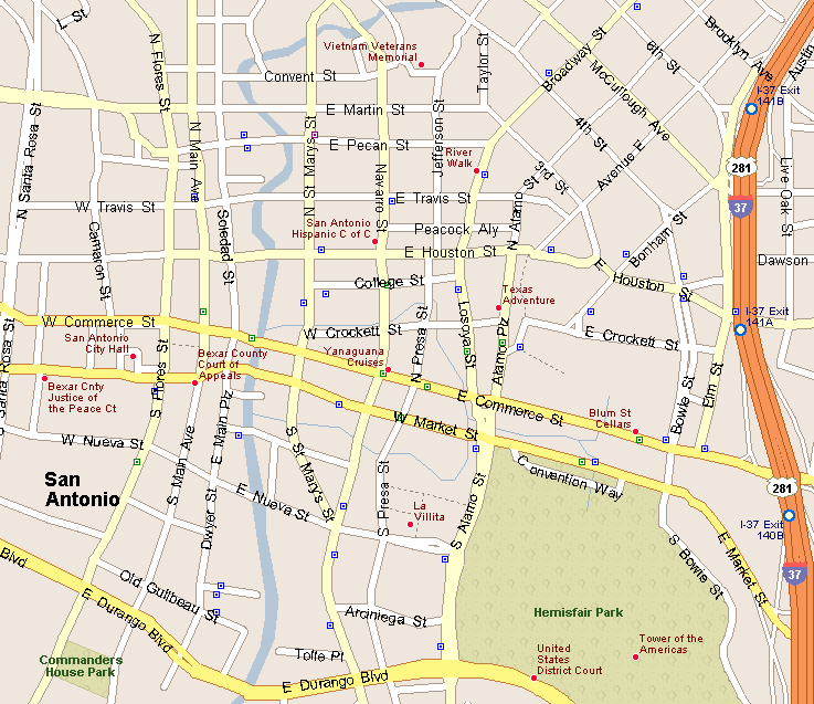
Map of Downtown San Antonio & River Walk Area |
|||
|
|||
|
|
|||
|
San Antonio International Airport is in north central San Antonio,
about 8 miles from downtown. There are 2 terminals serving 21 airlines
heading to 43 destinations, including 3 in Mexico. San Antonio has a mass transit system consisting of a bus and streetcar system run by VIA Metropolitan Transit (VIA). VIA has 84 bus routes and 3 downtown streetcar routes, including express service to park and ride locations with service to attractions like Six Flags Fiesta, SeaWorld and the University of Texas at San Antonio (UTSA).
San Antonio has around 136 miles of bike paths, including bike lanes on roads and off-road paths. In 2010 San Antonio began a bike sharing program, starting off with 140 bikes at 14 locations. |
|||
|
|||
|
|
|||
|
Visit our Eyes on Texas Blog
to make a comment or share info about San Antonio |
|||
|
|
|||
|
|
|||
| HOME TEXAS TOWNS PARADES | |||
|
|
|||
| BIG BEND COUNTRY | |||
| GULF COAST PINEY WOODS | |||
| PRAIRIE & LAKES HILL COUNTRY | |||
| SOUTH TEXAS PLAINS | |||
| PANHANDLE PLAINS | |||
|
|
|||
| San Antonio McAllen | |||
| Laredo Eagle Pass Poteet | |||
