|
|
|||
|
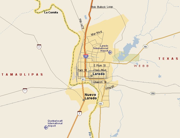
LAREDO TEXAS MAP |
|||
|
Laredo, Texas is the county seat of Webb County.
Laredo is located on the north bank of the Rio Grande River across
from Nuevo Laredo, Tamaulipas, Mexico. Laredo is south of the Edwards
Plateau, east of the Coastal Plains, west of the Mexican Mountains at
the west end of the Rio Grande Plains. In 2007 the population of Laredo was estimated to be 233,152. The population of Nuevo Laredo is approximately 350,000. Laredo and Nuevo Laredo are connected by 3 International Bridges and a Railroad Bridge. |
|
||
|
|||
|
The tallest building in Laredo is the Hamilton Hotel at 150 feet tall with 12 floors. The 2nd tallest building in Laredo is San Agustin Cathedral at 141 feet. El Metro is the name of the Laredo mass transit system. El Metro runs 21 fixed bus routes with 47 buses and 2 trolleys. The El Metro hub is downtown at the El Metro Transit Center, where you will also find Greyhound bus service. The names of the International Bridges are Juarez-Lincoln International Bridge, Gateway to the Americas International Bridge, Columbia-Solidarity International Bridge, World Trade International Bridge (for commercial traffic only), and the Texas-Mexican Railway International Bridge. |
|||
|
|
|||
|
|||
|
|
|||
|
Visit
our Eyes on Texas Blog to make a comment or share info about Laredo |
|||
|
|
|||
|
|
|||
| HOME TEXAS TOWNS PARADES | |||
|
|
|||
| BIG BEND COUNTRY | |||
| GULF COAST PINEY WOODS | |||
| PRAIRIE & LAKES HILL COUNTRY | |||
| SOUTH TEXAS PLAINS | |||
| PANHANDLE PLAINS | |||
|
|
|||
| San Antonio McAllen | |||
| Laredo Eagle Pass Poteet | |||
