|
|
|||
|
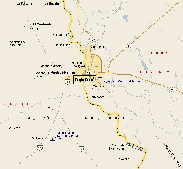
EAGLE PASS MAP |
|||
|
In the 1840s General William Leslie Cazneau
founded the Eagle Pass townsite, In 1850 Rick Pawless opened a trading
post he called Eagle Pass. Maverick County was established in 1871,
with Eagle Pass as the county seat. The City Hall of modern day Eagle Pass is located near the base of the International Bridge. Del Rio International Airport in Del Rio, Texas, via United Airlines provides airport service for the region. |
|
||
|
|||
|
Piedras Negras, Mexico is easy walking distance from downtown Eagle
Pass, across the Rio Grande. Piedras Negras is a bustling Mexican city
with a population of around 173,000. You will find handicraft products
at bargain prices in many shops and traditional Mexican market areas.
In summer you will find bullfights taking place in Piedras Negras. The
town has many restaurants and popular night clubs. |
|||
|
|
|||
|
|||
|
|
|||
|
Visit
our Eyes on Texas Blog to make a comment or share info about Eagle Pass |
|||
|
|
|||
|
|
|||
| HOME TEXAS TOWNS PARADES | |||
|
|
|||
| BIG BEND COUNTRY | |||
| GULF COAST PINEY WOODS | |||
| PRAIRIE & LAKES HILL COUNTRY | |||
| SOUTH TEXAS PLAINS | |||
| PANHANDLE PLAINS | |||
|
|
|||
| San Antonio McAllen | |||
| Laredo Eagle Pass Poteet | |||
