|
|
|||
|
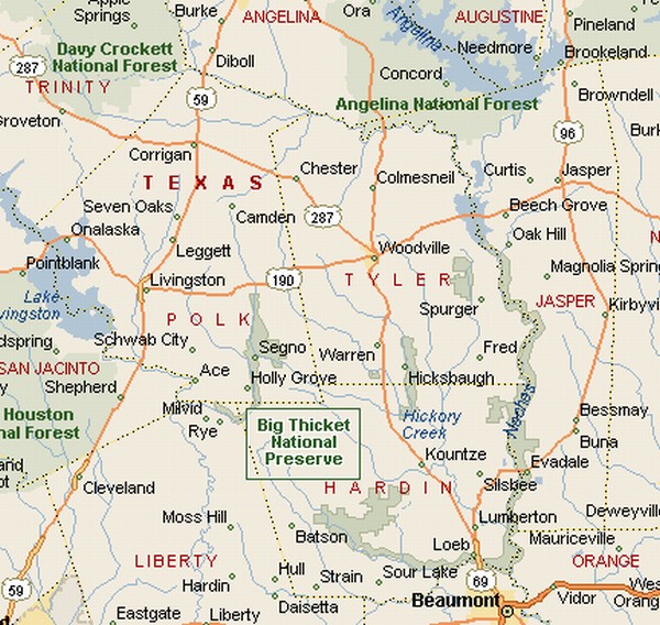
BIG THICKET
NATIONAL |
|||
|
UNESCO designated Big Thicket as a Biosphere Reserve in 1981. The Big Thicket has no exact boundaries, but it is sort of contained within boundaries set by the Neches River, San Jacinto River and Pine Island Bayou. There are small towns inside the Big Thicket. Most
came into being to support the logging industry. |
|
||
|
|
|||
|
|
|||
|
|||
|
|
|||
|
Visit
our Eyes on Texas Blog to make a comment or share info about the Big Thicket |
|||
|
|
|||
|
|
|||
| HOME TEXAS TOWNS PARADES | |||
|
|
|||
| BIG BEND COUNTRY | |||
| GULF COAST PINEY WOODS | |||
| PRAIRIE & LAKES HILL COUNTRY | |||
| SOUTH TEXAS PLAINS | |||
| PANHANDLE PLAINS | |||
|
|
|||
| Conroe Huntsville Jefferson | |||
| Nacogdoches Marshall Gilmer | |||
| Rusk Tyler Kilgore | |||
| Big Thicket National Preserve | |||