|
|
|||
|
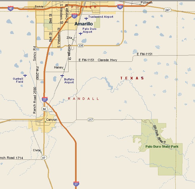
PALO DURO CANYON MAP |
|||
|
Palo Duro Canyon is the second largest canyon in the United States. Palo Duro is part of the Caprock Escarpment in the Texas Panhandle. Palo Duro is approximately 120 miles long, with an average width of 6.2 miles, reaching a width of 20 miles in some locations. Palo Duro Canyon ranges from 820 to 997 feet deep. Palo Duro Canyon sprawls over Randall, Armstrong and Briscoe Counties. The head of Palo Duro Canyon is 5 miles northeast of Canyon, in Randall County. The mouth of Palo Duro Canyon is 22 miles north-northeast of Quitaque in Briscoe County. |
|
||
|
|||
|
During the summer tourist season the historical musical drama called Texas takes place in the Pioneer Amphitheater in Palo Duro Canyon. Texas is the official state play of Texas. The play tells the history of pioneer life in the late 19th century, using music, special effects, song and dance with the canyon walls as backdrop. |
|||
|
|
|||
|
|||
|
|
|||
|
Visit
our Eyes on Texas Blog to make a comment about Palo Duro Canyon |
|||
|
|
|||
|
|
|||
| HOME TEXAS TOWNS PARADES | |||
|
|
|||
| BIG BEND COUNTRY | |||
| GULF COAST PINEY WOODS | |||
| PRAIRIE & LAKES HILL COUNTRY | |||
| SOUTH TEXAS PLAINS | |||
| PANHANDLE PLAINS | |||
|
|
|||
| Abilene Amarillo Archer City | |||
| Mineral Wells Sweetwater | |||
