|
|
||
|
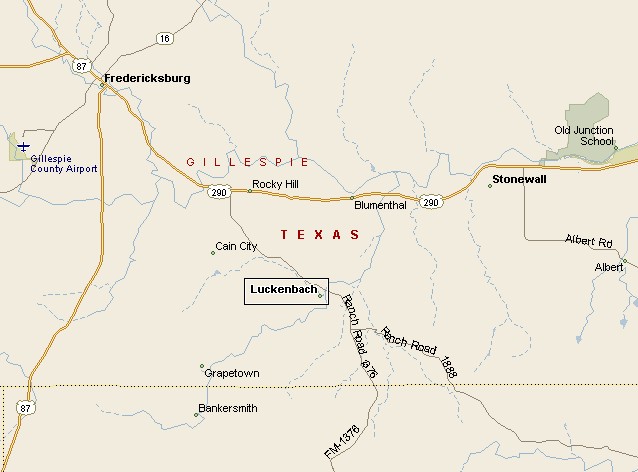
LUCKENBACH MAP |
||
|
|
||
|
Don't count on roadsigns directing you to Luckenbach, Texas. Souvenir bandits steal the signs as soon as they are put up. You can find Luckenbach with outside roadsigns. Luckenbach is about 13 miles southeast of Fredericksburg, exit Highway 290 and head 5 miles south, til you find Luckenbach just off FM 1376. Luckenbach is an unincorporated town in Gillespie County almost 10 acres in size. Located between a tributary of the Pedernales River called South Grape Creek and Snail Creek. Luckenbach is about 70 miles west of Austin and 50 miles north of San Antonio. |
||
|
||
|
|
||
|
||
|
|
||
|
Visit
our Eyes on Texas Blog to make a comment or share info about Alpine |
||
|
|
