|
|
|||
|
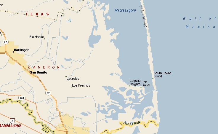
SOUTH PADRE ISLAND MAP |
|||
|
South Padre Island was badly damaged in September of
1967 by Hurricane Beulah and again on July 23, 2008 by Hurricane
Dolly. South Padre Island is named after a Catholic priest named Jose Nicolas Balli, also known as Padre Balli. |
|
||
|
|
|||
|
|
|||
|
|||
|
|
|||
|
Visit
our Eyes on Texas Blog to make a comment or share info about South Padre Island |
|||
|
|
|||
|
|
|||
| HOME TEXAS TOWNS PARADES | |||
|
|
|||
| BIG BEND COUNTRY | |||
| GULF COAST PINEY WOODS | |||
| PRAIRIE & LAKES HILL COUNTRY | |||
| SOUTH TEXAS PLAINS | |||
| PANHANDLE PLAINS | |||
|
|
|||
| Deer Park Galveston Harlingen | |||
| Houston Kemah Kingsville Matagorda | |||