|
|
|||
|
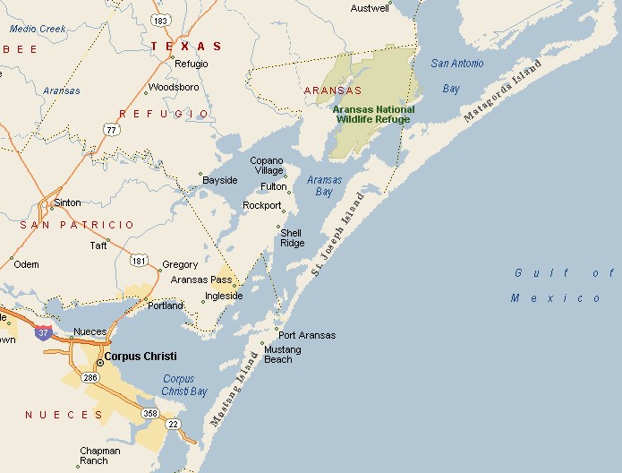
PORT ARANSAS AREA MAP |
|||
|
Port Aransas is connected to its mainland partner, Aransas Pass, by a free five-minute ferry boat ride. Port Aransas is in Nueces County, averaging about 7 feet above sea level, thus very vulnerable to storm surges. It is believed the first residents of the Port Aransas area were the Karankawa Indians. This was a cannibalistic tribe of man-eaters, who covered themselves in tar that oozed out of the Gulf of Mexico, to keep mosquitoes from biting them. |
|
||
|
|
|||
|
|
|||
|
|||
|
|
|||
|
Visit
our Eyes on Texas Blog to make a comment or share info about Port Aransas |
|||
|
|
|||
|
|
|||
| HOME TEXAS TOWNS PARADES | |||
|
|
|||
| BIG BEND COUNTRY | |||
| GULF COAST PINEY WOODS | |||
| PRAIRIE & LAKES HILL COUNTRY | |||
| SOUTH TEXAS PLAINS | |||
| PANHANDLE PLAINS | |||
|
|
|||
| Deer Park Galveston Harlingen | |||
| Houston Kemah Kingsville Matagorda | |||