|
|
|||
|
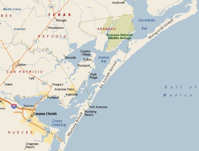
CORPUS CHRISTI AREA MAP |
|||
|
|
|||
|
Corpus Christi has an average temperature just above 71 degrees. The town is a year round recreation destination. In addition to fishing, golf, sailing and windsurfing are popular. |
|||
|
Corpus Christi got its name thanks to Spanish explorer, Alonso Alvarez de Pineda who discovered what he thought to be a beautiful bay in 1519 and proceeded to name it after a religious feast day called Corpus Christi. Over 3 centuries later, US troops, under the command of General Zachary Taylor, set up camp in Corpus Christi to get ready to battle Mexico. In the 1920s the federal government turned Corpus Christi Bay into a deep water port, the deepest in Texas, by dredging the bay and the shipping channel, turning Corpus Christi into a thriving port city. |
|
||
|
|
|||
|
Corpus Christi has a humid sub-tropical climate, with less precipitation than other areas of the Gulf Coast Region. Buccaneer Days Carnival is an annual downtown Corpus Christi celebration. South Padre Island Drive, which is abbreviated as S.P.I.D., which is how the locals refer to it, pronouncing the letters separately, is the main retail corridor of Corpus Christi, with 2 shopping malls, one called La Palmera, the other Sunrise Mall. |
|||
|
|
|||
|
|||
|
|
|||
|
Visit
our Eyes on Texas Blog to make a comment or share info about Corpus Christi |
|||
|
|
|||
|
|
|||
| HOME TEXAS TOWNS PARADES | |||
|
|
|||
| BIG BEND COUNTRY | |||
| GULF COAST PINEY WOODS | |||
| PRAIRIE & LAKES HILL COUNTRY | |||
| SOUTH TEXAS PLAINS | |||
| PANHANDLE PLAINS | |||
|
|
|||
| Deer Park Galveston Harlingen | |||
| Houston Kemah Kingsville Matagorda | |||