|
|
||
|
TERLINGUA MAP |
||
|
|
||
|
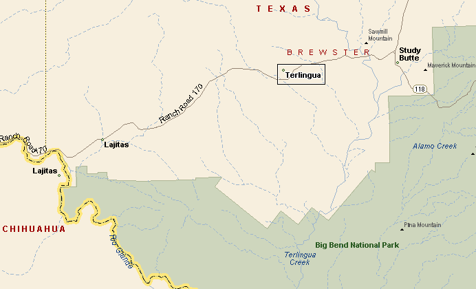
Terlingua is in southwester Brewster County, north and west of Big Bend National Park. Nearby towns are Lajitas and Study Butte. Across the Rio Grande is the Mexican village of Santa Elena. On Presidents Day weekend Desert Sports sponsors a mountain bike race called Mas o Menos 100, featuring a 100 kilometer mountain bike race over tough Chihuahuan Desert territory. |
||
|
|
||
|
|
||
|
||
|
|
||
|
Visit
our Eyes on Texas Blog to make a comment or share info about Terlingua |
||
|
|
||
|
HOME | TEXAS TOWNS | PARADES |
||
|
TERLINGUA MAP |
||
|
|
||
| HOME TEXAS TOWNS PARADES | ||
|
|
||
| BIG BEND COUNTRY | ||
| GULF COAST PINEY WOODS | ||
| PRAIRIE & LAKES HILL COUNTRY | ||
| SOUTH TEXAS PLAINS | ||
| PANHANDLE PLAINS | ||
|
|
||
| Del Rio El Paso Fort Davis | ||
| Fort Stockton Langtry Marfa | ||
| Midland Monahans Odessa Pecos | ||
| Sanderson Terlingua Wink | ||
| Guadalupe Mountains National Park | ||