|
|
|||
|
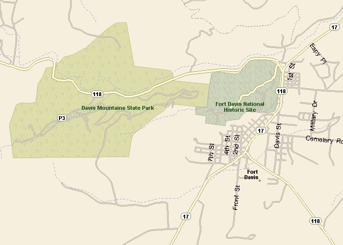
FORT DAVIS MAP |
|||
|
|
|||
|
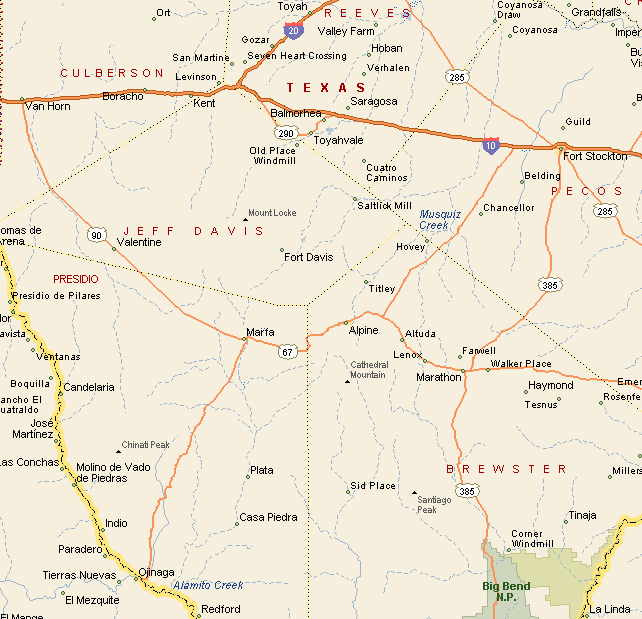
Texas State Highways 118 and 17 take you to Fort
Davis. Heading south from Fort Davis, on Highway 17, takes you to
Marfa in about 20 miles. Heading south on Highway 118 takes you to Alpine in about 25 scenic miles. Heading south from Interstate 10 on Highway 118 it is approximately 50 miles to Fort Davis. Exit Interstate 10 on to Highway 290, then when you get to Toyahvale turn on to Highway 17 and then head south approximately 30 miles to Fort Davis. |
|
||
|
|
|||
|
The elevation of Fort Davis is 5,050 feet above sea level. Fort Davis is the county seat of Jeff Davis County. Fort Davis is the highest county seat in Texas. At last count there were 1,041 residents of Fort Davis. |
|||
|
|
|||
|
|||
|
|
|||
|
|||
|
|
|||
|
Visit
our Eyes on Texas Blog to make a comment or share info about Fort Davis |
|||
|
|
|||
|
|
|||
| HOME TEXAS TOWNS PARADES | |||
|
|
|||
| BIG BEND COUNTRY | |||
| GULF COAST PINEY WOODS | |||
| PRAIRIE & LAKES HILL COUNTRY | |||
| SOUTH TEXAS PLAINS | |||
| PANHANDLE PLAINS | |||
|
|
|||
| Del Rio El Paso Fort Davis | |||
| Fort Stockton Langtry Marfa | |||
| Midland Monahans Odessa Pecos | |||
| Sanderson Terlingua Wink | |||
| Guadalupe Mountains National Park | |||