|
|
||
|
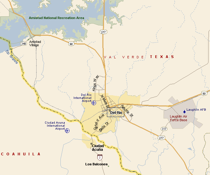
DEL RIO TEXAS MAP |
||
|
|
||
|
Del Rio is the county seat of Val Verde County. Del
Rio connects to Ciudad Acuna, Mexico by the Lake Amistad Dam
International Crossing and Del Rio-Cuidad Acuna International
Bridge. The population of Del Rio at last count was 50,135. Del Rio International Airport serves Del Rio and the surrounding area. Amtrak's Sunset Limited passes through Del Rio Station on its way east through San Antonio and on to New Orleans, and west through El Paso on its way to Los Angeles. |
||
|
|
||
|
|
||
|
||
|
|
||
|
Visit
our Eyes on Texas Blog to make a comment or share info about Del Rio |
||
|
|
||
|
|
||
| HOME TEXAS TOWNS PARADES | ||
|
|
||
| BIG BEND COUNTRY | ||
| GULF COAST PINEY WOODS | ||
| PRAIRIE & LAKES HILL COUNTRY | ||
| SOUTH TEXAS PLAINS | ||
| PANHANDLE PLAINS | ||
|
|
||
| Del Rio El Paso Fort Davis | ||
| Fort Stockton Langtry Marfa | ||
| Midland Monahans Odessa Pecos | ||
| Sanderson Terlingua Wink | ||
| Guadalupe Mountains National Park | ||