|
|
||
|
BIG BEND |
||
|
|
||
|
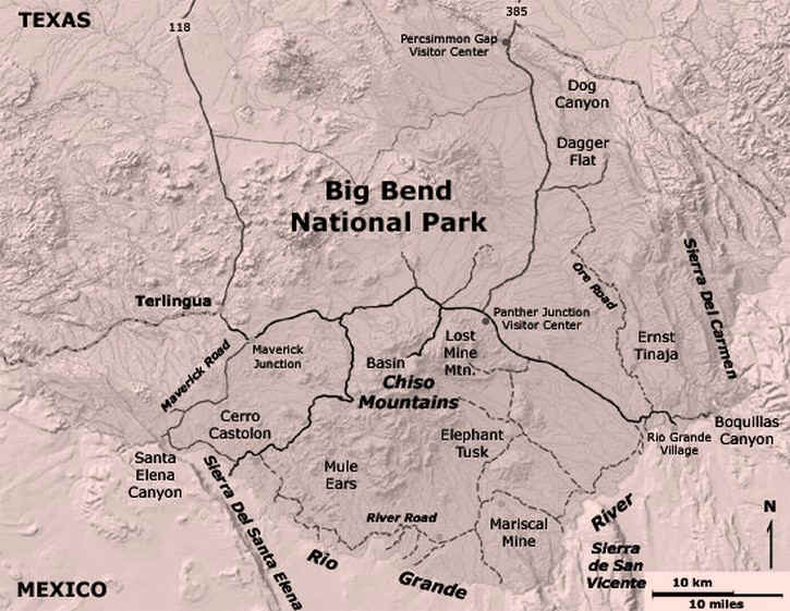
Big Bend National Park is so-named because of the big
curve the Rio Grande River makes as it flows into Southwest Texas. Big Bend National Park and Big Bend Ranch State Park cover over one million acres of public land, where visitors can camp, river raft, mountain bike, horse ride, hike, jeep and sightsee. |
||
|
|
||
|
|
||
|
||
|
|
||
|
Visit
our Eyes on Texas Blog to make a comment about Big Bend National Park |
||
|
|
||
|
|
||
| HOME TEXAS TOWNS PARADES | ||
|
|
||
| BIG BEND COUNTRY | ||
| GULF COAST PINEY WOODS | ||
| PRAIRIE & LAKES HILL COUNTRY | ||
| SOUTH TEXAS PLAINS | ||
| PANHANDLE PLAINS | ||
|
|
||
| Del Rio El Paso Fort Davis | ||
| Fort Stockton Langtry Marfa | ||
| Midland Monahans Odessa Pecos | ||
| Sanderson Terlingua Wink | ||
| Guadalupe Mountains National Park | ||