|
|
|||
|
BLACK MESA STATE
PARK |
|||
|
|
|||
|
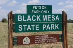
Black Mesa State Park has RV and tent campsites, picnic areas, hiking trails, trout fishing, restrooms with showers, bunkhouses for group camping, a mooring buoy and boat ramps. Yet, even though the park has boat ramps this is no boat access to Lake Carl Etling. |
|||
|
Black Mesa State Park is 28 miles northwest of Boise City on Highway 325. The park covers 349 acres, has 64 campsites, the bunkhouses can hold 120. Black Mesa extends from Mesa de Maya in Colorado southeast 28 miles along the north bank of the Cimarron River, crossing the far northeast corner of New Mexico, ending where the Cimarron River and Carrizo Creek meet up near the town of Kenton in the Oklahoma Panhandle. |
|
||
| Black Mesa got its name from the layer of black lava that covered the mesa about 30 million years ago. | |||
|
|
|||
|
|||
|
|||
|
|
|||
| HOME TEXAS TOWNS PARADES | |||
|
|
|||

 Oklahoma's highest point is in Black Mesa Nature Preserve in the Oklahoma
panhandle. The summit of Black Mesa is 4,973 above sea level.
Oklahoma's highest point is in Black Mesa Nature Preserve in the Oklahoma
panhandle. The summit of Black Mesa is 4,973 above sea level.